

GEOGRAPHICAL LAYOUT
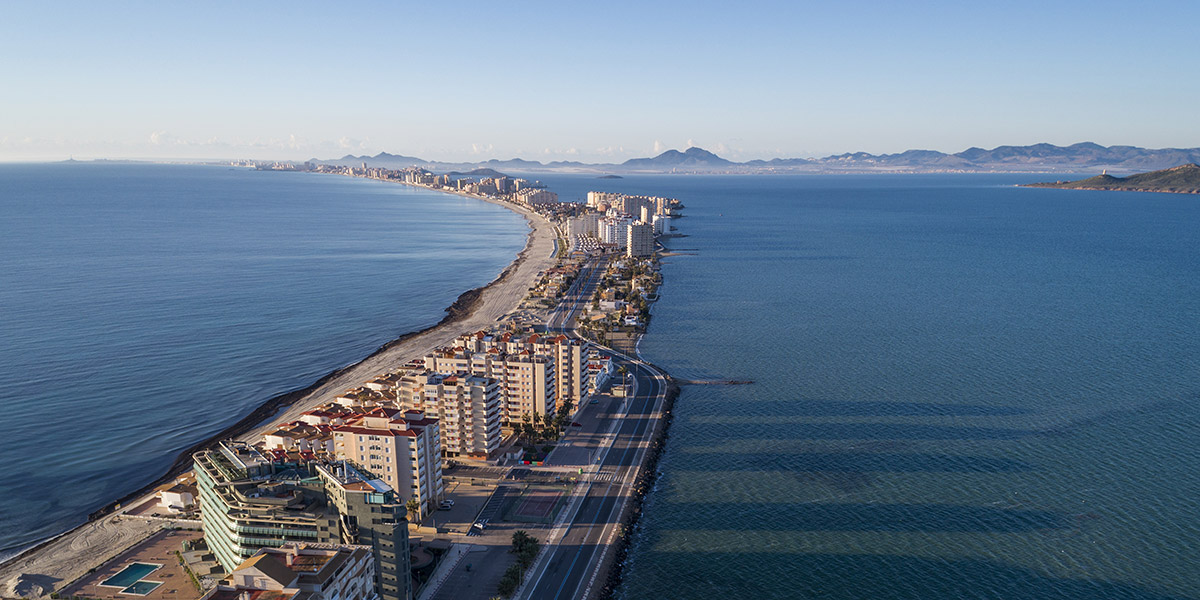
The descriptive name of La Manga (the sleeve) holds an interesting geographical layout which has become one of the symbols that best identifies the coast of Murcia as a tourist resort: a chain that stretches along approximately 21 km from Cabo de Palos to the Veneziola, and is the natural limit of the salt water lake known as the Mar Menor. Originally, what is now known as La Manga del Mar Menor was a bay open to the Mediterranean; at either end, volcanic reefs gradually held back the sand and sediment that was dragged along by the sea currents to form a sandy column of dunes and rock vegetation and long beaches in contact with two seas: the Mediterranean and the Menor. La Manga is a narrow piece of land with a width that varies between 200 m and 1 and a half km. It is cut off by natural channels that keep the two seas in contact with each other; the so-called "golas" allow water from the Mediterranean into the lake. As such, the space was kept virgin until the 60's, when La Manga was "discovered" as a tourist resort and underwent a transformation which included the urbanisation of the area and the construction of tourist infrastructures.


")
")
")
")
 (3h)")
")


